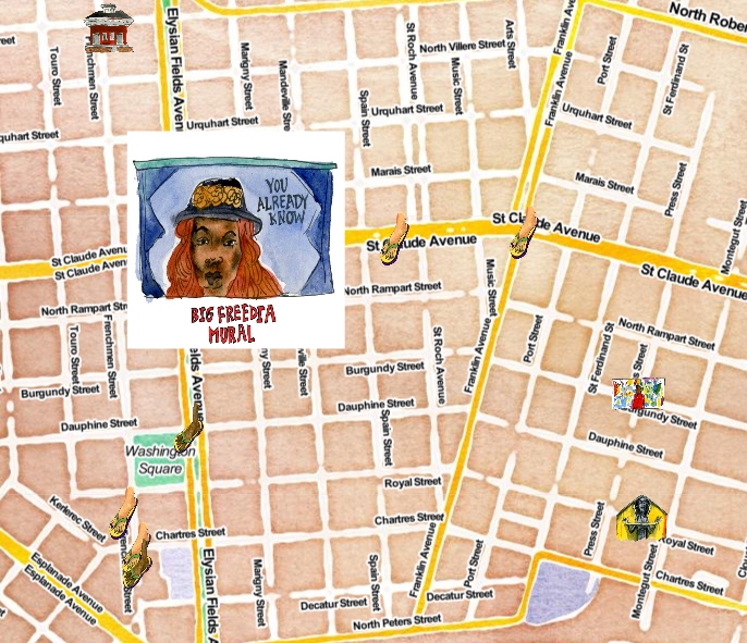
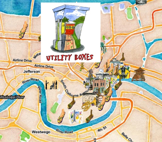
Interactive public art map created by Kelley Crawford, Emma Fick, and Steven Melendez.
Editors Note: The following series “Beyond the Beignets: A deeper look at New Orleans” is a week-long series curated by Rena Repenning as part of the Digital Research Internship Program in partnership with ViaNolaVie. The DRI Program is a Newcomb Institute technology initiative for undergraduate students combining technology skillsets, feminist leadership, and the digital humanities.
Because I live in New Orleans as a Tulane student, I often feel like a visitor instead of a resident because Tulane’s social life is disconnected from the city’s year-round residents. When creating Beyond the Beignets, I compiled 10 articles that articulated an often overlooked part of city life. Word of mouth and advertisements usually only spread well known, and usually trite, tourist attractions. By using technology, NOLA visitors can broaden their view from the comfort of their hotel or airbnb. Six women from ViaNolaVie and Emerging Philanthropists of New Orleans are responsible for the creation of Footprints: An Interactive Public Art Map. This multimedia resource shows the “footprint” of many locations around NOLA, using colorful illustrations.
This article was originally published on March 20th, 2019.
Six months ago four women from EPNO (Emerging Philanthropists of New Orleans) and two women from NolaVie sat around a table in an office that overlooked the river.
“We want to create an interactive public art map,” I (managing editor at NolaVie) and Renee Peck (editor and co-founder of NolaVie), said.
From there, a new partnership with artist and author Emma Fick formed and so did design meetings with writer and digital map maker Steven Melendez. By using both the archives of ViaNolaVie, which has over 6,000 stories on arts and culture in New Orleans, and working with local writers, students, and photographers, “Footprints: An Interactive Public Art Map” was created. There is a mix of illustrations (all by artist Emma Fick), audio, and video to accompany the text that maps out over 60 public art pieces in New Orleans.
Take a look, take a walk, and enjoy the museum of our city streets!
Click here to use the map!
This art map was created by Kelley Crawford, Steven Melendez, and Emma Fick. It was made possible through a grant provided by EPNO (Emerging Philanthropist of New Orleans). We would like to dedicate this map, which will continue to grow, to Sharee Wells, the executive director of EPNO who made this project — and many others like it — possible. She will always be in our hearts, our minds, and within the beauty of New Orleans forever.
Interactive public art map created by Kelley Crawford, Emma Fick, and Steven Melendez.
