By the River (Photo by Jesse James, Wiki Media Commons)
Part 1: The Problem and Why its a Problem
New Orleans is a sinking city. That is just the plain facts; New Orleans sinks approximately 2 inches per year, (Szydlowski) and there is not much anyone can do about it. What can be done is preventing the city from constantly flooding and being destroyed by hurricanes. The city was not always below sea level and sinking, for those wondering why would settlers build a city destined to disappear? New Orleans’ fate was sealed by human interaction, not because of natural causes.
To explain the root of this problem, we have to discuss some of New Orleans’ history. The original and first known residents of the New Orleans area were the Native Americans of the Chitimacha Tribe of Louisiana and they did not have any problem with New Orleans sinking (Bjarnagin). In 1718, the governor of French Louisiana, Jean-Baptiste Le Moyne, Sieur de Bienville, founded Nouvelle-Orléans on high ground by the mouth of the Mississippi River (History.com Editors), just around 10 feet above sea level (Prior). It was always known that New Orleans was built on loose soil, with fear that the soil could not support high-raised buildings. Then in 1763, the city was ruled by the Spanish for 40 years.
Eventually, New Orleans became a part of the United States through the Louisiana Purchase in 1803. This is where the problem starts to occur. A drainage system was put in place in 1896 that was intended to allow the expansion of the city onto land that was formerly marshes and swamps (Szydlowski). Pumping the water out of these areas for development caused unforeseen consequences, Tulane Architecture professor and geographer, Richard Campanella, says this “starved the land of replenishing sediment” (Prior). Why does this matter? Sediment is solid material, made up of rocks, minerals, and remains of plants and animals, that is moved and deposited in different locations to form land and provide nutrients and minerals that are extremely important for the health of downstream ecosystems (Sediment as an Ecological Function). Usually, sediment is replaced naturally by the flooding of the Mississippi River (Szydlowski). By building and expanding New Orleans, the process has been stopped. Dams and walls built around the river to prevent flooding have, in turn, stopped more sediment from being deposited in the area. Without sediment being replenished, air pockets form below the surface and the soil sinks to fill those air pockets. It has become an endless cycle, with wanting to prevent the city from flooding but causing the city to slowly sink, which increases the chances of flooding.
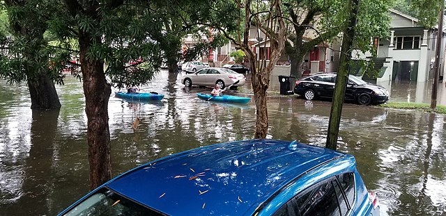
Frequent flooding in the streets and residential areas. (Photo by Bart Everson, Wiki Media Commons)
Along with the prevention of new sediment into the areas, climate change around the world has caused ocean levels to rise due to the warming climate (Lindsey). Climate change is causing sea levels to rise for a couple of reasons. The first being the melting of glaciers and ice sheets around the world, this adds more water to the ocean. The amount of additional water being put in the ocean due to melting of glaciers has been increasing over the years, with the equivalent of 18 inches in the 1990s to 20 inches in the 2000s to 33 inches in 2010-2018. Not only glaciers are melting, the Greenland Ice Sheet melted 247 billion tons of water per year between the years of 2012-2016 and the Antarctic ice loss melted 199 billion tons of water per year between the same years. This melting is not the only factor in sea levels rising but also, the water warming has caused the volume of the ocean to expand (Lindsey). With ocean levels rising and the ground sinking, New Orleans has become officially classified as a sinking city (Brennan).
Now that the reason for New Orleans’ sinking problem has been explained, what does all of this mean for the city? Although no one can stop New Orleans from sinking because the damage has already been done, the problem causes the city to be susceptible to flooding and vulnerability to hurricanes destroying the city due to many of the areas being below sea level (Below et al.). Lower income areas, like the Lower Ninth Ward, have shown to be the lowest-lying areas so the most likely to flood (Gibbens). Levees were built to prevent storm surges, when oncoming storms push seawater onto land, from causing so much damage but these levees have failed to do that in the past. In 2005, New Orleans experienced “one of the worst storms in U.S. history”, Hurricane Katrina. Hurricane Katrina caused storm surges to go as high as 19 feet, flooding the city and creating around $108 billion in damages (Gibbens). To prevent the city from being completely underwater, 17.5-foot levees were built but they need to be raised repeatedly. Engineers also built 18-foot tall flood-protection levees along the Mississippi River to make sure the river level is at about 14-feet above sea level but with these levees being built, it continues to prevent sediment from replenishing (Lemmons).
Part two: Solution
Much like New Orleans, the country of the Netherlands faces issues of flooding and almost a third of its area is below sea level (Dutch Water Facts). The country has a similar set up as New Orleans, with dikes, which are very much like levees, built around the coast. Around 55% of the country’s housing is placed in areas that are likely to flood from the Rhine, Meuse, Waal, and Ijssle Rivers (ClimateWire). In the past, the Netherlands has been building higher and higher dikes to keep the water out. The national government realized that if they kept just making the dikes taller, then the damage would be much greater if anything goes wrong (ClimateWire). With climate change making the problem worse, they decided to come up with a new plan called the “Room for the River” program (Room for the River Programme).
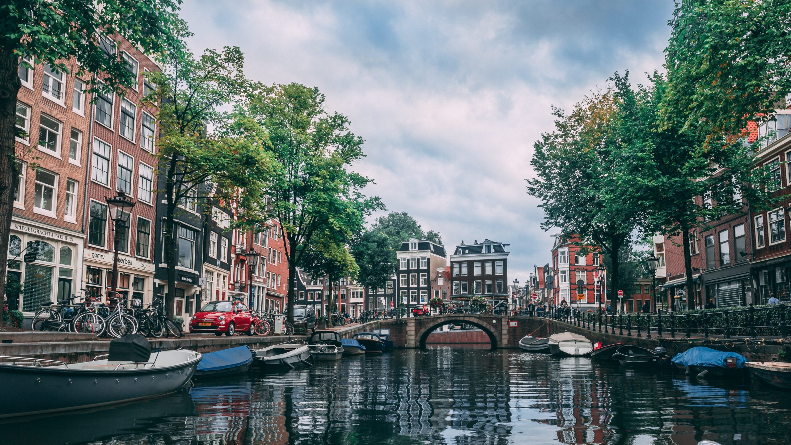
The Netherlands has learned to embrace the water, rather than have a constant battle with it. (Photo by Chait Goli, Pexels)
The Room for the River program’s purpose is to “work with nature instead of against it” (Sellers). This is done by pushing the dikes back further inland to give the river more room to flow. According to the Dutch Water Sector, the higher water levels in the surrounding rivers are managed by lowering the levels of the flood plains, creating water buffers, relocating levees, increasing the depth of the side channels, and the construction bypasses (Room for the River Programme). The goal is to “restore the river’s natural floodplain in places where it is least harmful in order to protect those areas that need to be defended” (Room for the River Programme). This approach, facing climate change, has proved to be better for the environment because in order for it to be effective, dunes and mud flats need to be maintained, salt marshes and barrier islands are protected, and the concrete of the dikes are reinforced with swamps and sands. To create buffers against the flooding river, artificial reefs are created. The flood defense encourages “the natural transportation of sand by water and wind” (Sellers).
The plan has been put in place at more than 30 locations and the rivers have been able to flood safely, without causing damage like it has in the past. It has been shown to “improve the quality of the immediate surroundings” (ClimateWire). In Nijmegen, the country’s oldest city, a dike was pushed 350 meters (1148.29 feet) inland and a channel, that is also used for rowing and sailing, was created for the Waal River. This created a new island in the center of Nijmegen and it became an urban park. Additionally, a new bridge was created over the Waal and it created more accessibility in the area. Designers and architects were able to take cultural and historic landmarks into account when creating this new plan, carving out to make sure that they remained safe and untouched. This plan did not come without controversy, as around 50 houses were needed to be demolished to create the space for the plan, the government was able to give either financial compensation or new land for the property owners to live on instead. This design has already been awarded “Excellence on the Waterfront Honor Award 2011” from Washington, D.C.-based Waterfront Center for its flood safety and sustainability in urban areas (ClimateWire).
Part 3: How Could This Work for New Orleans
Could the Room for the River program work for New Orleans? The simplified answer is yes, but the city will need to be willing to put the effort into the project. New Orleans currently is just building its flood protection levees higher and reinforcing them with more concrete, much like the Dutch did. If the Room for the River plan is adopted, it could prevent the frequency of flooding in lower income areas and possibly could stop New Orleans from sinking at the faster rate it currently is. The return of swamps and marshes in the areas surrounding the levees would allow more sediment to be replenished and maintain more stability in the soil, slowing down the sinking. Following the Room for the River program, cultural and historical areas in New Orleans will be able to be preserved, even with the moving the levees back, and safer from damages that could be caused by flooding.
After Hurricane Katrina, New Orleans and the rest of the world witnessed how destructive the forces of nature could really be. Costing billions of dollars in damages and changing the lives of thousands, the city deserves a change that would prevent something like that from ever happening again. The Room for the River program has shown, in the Netherlands, to reduce the costs of damages caused by flooding and could be just as effective in New Orleans. The current flood protection systems and drainage system already put in place would not need to be removed, but they would be more effective because less pressure will be held onto them. There would be not as much requirement to continuously make the levees higher and reinforced with more concrete. The way the current systems work are simply not as effective as the designers would have hoped and implementing the Room for the River program could increase the protection around the city. As climate change’s dire effects are increasing as time goes on, this solution would be in the city’s best interest for the long-term.
Like the Netherlands, many housing and business areas are located near the coast and will need to be relocated. This will cause a lot of controversy for the people of New Orleans because people will need to move from areas where they have lived or operated from for years. Through eminent domain in the Fifth Amendment to the U.S. Constitution, the federal government would have the power to buy the land required from the property owners with reasonable compensation, as the Dutch government had to do. Although this issue may outrage many, the outcome of moving the levees will be for the betterment of the entire community.
Works Cited
Below, Chris, et al. “Environmental Hazards Storm Surge Induced Flooding in New Orleans.” Why New Orleans Is Vulnerable, https://people.uwec.edu/jolhm/eh3/group7/WhyNOVulnerable.htm.
Bjarnagin. “Indigenous Tribes of New Orleans & Louisiana.” American Library Association , 8 May 2018, https://ala.org/aboutala/offices/nola-tribes.
Brennan, Pat. “Big Coastal Cities Sink Faster than Seas Rise – Climate Change: Vital Signs of the Planet.” NASA, NASA, 1 Sept. 2016, https://climate.nasa.gov/news/2487/big-coastal-cities-sink-faster-than-seas-rise/.
ClimateWire. “How the Dutch Make ‘Room for the River’ by Redesigning Cities.” Scientific American, Scientific American, 20 Jan. 2012, https://www.scientificamerican.com/article/how-the-dutch-make-room-for-the-river/.
“Dutch Water Facts – Holland.com.” Netherlands, https://www.holland.com/global/tourism/information/general/dutch-water-facts.htm.
Gibbens, Sarah. “Hurricane Katrina Facts and Information.” Environment, National Geographic, 3 May 2021, https://www.nationalgeographic.com/environment/article/hurricane-katrina#:~:text=More%20than%2050%20levees%20would,worst%20impacts%20and%20most%20deaths.
History.com Editors. “New Orleans.” History, A&E Television Networks, 5 Apr. 2010, https://www.history.com/topics/us-states/new-orleans.
Lemmons, Richard. “Hurricane Katrina and the Continued Threat to New Orleans – Plate Tectonics.” Climate Policy Watcher, 7 Jan. 2022, https://www.climate-policy-watcher.org/plate-tectonics/hurricane-katrina-and-the-continued-threat-to-new-orleans.html.
Lindsey, Rebecca. “Climate Change: Global Sea Level.” Climate Change: Global Sea Level | NOAA Climate.gov, 2020, https://www.climate.gov/news-features/understanding-climate/climate-change-global-sea-level#:~:text=What’s%20causing%20sea%20level%20to,expanding%20as%20the%20water%20warms.
Prior, Ryan. “Why New Orleans Is Vulnerable to Flooding: It’s Sinking.” CNN, Cable News Network, 11 July 2019, https://www.cnn.com/2019/07/10/us/new-orleans-sinking-into-sea-trnd/index.html.
“Room for the River Programme.” Room for the River Programme | Dutch Water Sector, 15 Apr. 2019, https://www.dutchwatersector.com/news/room-for-the-river-programme.
Sellers, Frances Stead. “Dutch Making Room for Water.” Spokesman.com, The Spokesman-Review, 30 June 2009, https://www.spokesman.com/stories/2005/sep/16/dutch-making-room-for-water/.
“Sediment as an Ecological Function.” Sediment as an Ecological Function – King County, https://kingcounty.gov/services/environment/water-and-land/shorelines/about/shoreline-ecology/sediment.aspx.
Szydlowski, Mike. “New Orleans Was Built above Sea Level, but the Sinking City Tries to Weather Hurricane Ida.” Columbia Daily Tribune, Columbia Daily Tribune, 1 Sept. 2021, https://www.columbiatribune.com/story/lifestyle/2021/09/01/sinking-new-orleans-tries-weather-hurricane-ida/8254812002/.
This piece was edited by Evan Price as part of Professor Kelley Crawford’s Digital Civic Engagement course at Tulane University.
