Editor’s note: This week, we’re running a series of guest blogs from the contributors of “Unfathomable City: A New Orleans Atlas,” a book of 22 full-spread maps and 20 essays. The book was co-authored and directed by Rebecca Solnit and Rebecca Snedeker and features the work of a diverse group of cartographers, writers, researchers, photographers, and visual artists. This series gives voice to the principal cartographer, a researcher, and a visual artist. They discuss their roles and reflect on participating in the atlas, as well as their deeper exploration and understanding of New Orleans through this experience.
Today’s content comes from researcher Audrey Cropp about undertaking the impossible challenge of mapping every live oak tree in New Orleans for the Atlas map titled “The Line-Up,” which maps both live oak corridors and Carnival parade routes.
Read Atlas cartographer Shize Seigel’s guest blog here, and check back Thursday for the third installment of the series, from the book’s visual arts perspective.
By Audrey Cropp
I am not a New Orleanian.
I was not born in the South, nor did I grow up in the Crescent City; however I do not lament this fact.
On the contrary, being an outsider when I arrived in New Orleans for the first time made me delightfully unprepared for what I found. Colors were brighter, food tasted better, music was sweeter, upside down and wide eyed trying to not miss a moment, I caught the bug as they say, and I fell madly in love.
Three years later, when I got the invite to do research for a New Orleans-based atlas, I smiled. An atlas for a city where cardinal directions don’t exist — of course I was in.
At the time, I was studying landscape architecture at LSU, and the challenge extended was to map the city’s iconic live oak trees. All of them. The task, while straightforward enough, was not a small one. So I teamed up with my dear friend and colleague Amanda Beerens to take on the documentation of every Quercus virginiana and its location in the city.
We started in our lab at LSU, pouring over maps, Google Earth images, satellite photography. We used anything we could get our hands on to try and wrap our heads around what we had gotten ourselves into. Do we count them? Does age matter? Is an absolute location the goal or the area of reach by the lazy limbs? Clearly on the ground research was imperative … road trip.
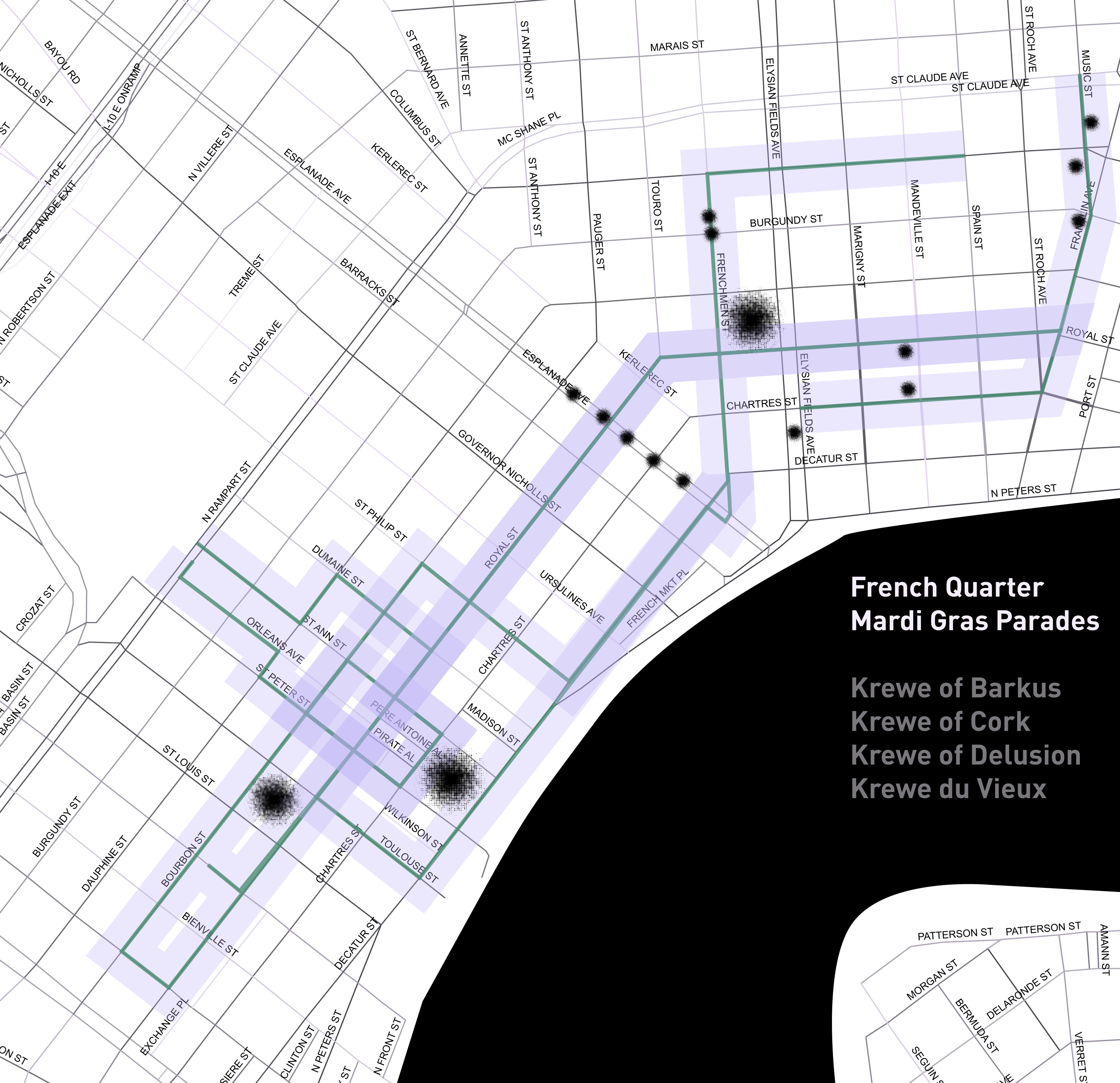
An early rendering of the parade routes in the French Quarter, with trees
We drove through the streets, taking pictures, video, counting, recounting, and counting again. We did this on every street in New Orleans — one of us driving, while the other marked our findings on one of the many maps that now littered my car.
It became clear to us that the feeling the live oaks give the streets isn’t created by one mammoth tree. Much like everything else in New Orleans, it’s the way it all fits together. The research led us to split our findings into two categories: Areas with oak tree-lined streets were either the cathedral, or the aisle. The cathedral was a corridor where not only did the trees line the streets, but where their branches reached overhead to meet the trees on the other side, hugging the street. The aisle corridors were lined on both sides of the street and did not meet in the middle. These areas, while not as haunting nor breathtaking as the cathedral, had a special place in our hearts as we created this map. We knew we were cataloging the future cathedrals for people to look back on and get an idea of what the city looked like in this time of transition and tumult, before branches met in the middle. We retraced our steps, finalized our notes, and sent them back. A road map of trees that hugged the streets of New Orleans.
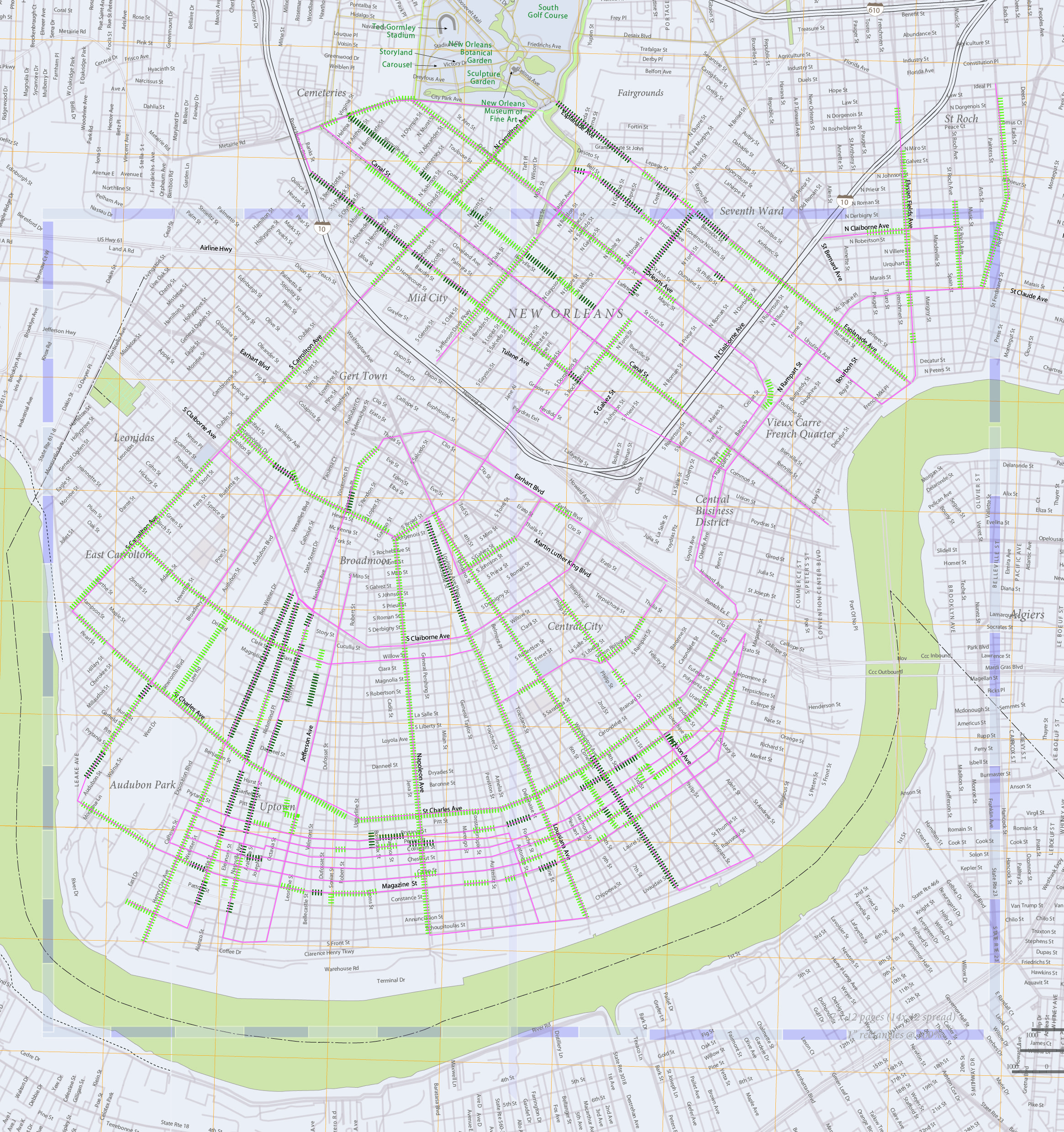
The submitted mapping with field documentation
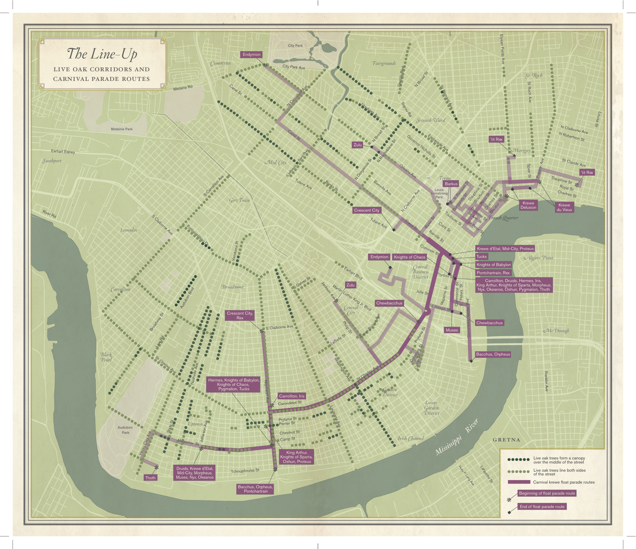
The final version of ‘The Line-Up’ featured in Unfathomable City: A New Orleans Atlas
Audrey Cropp is a graduate student at the Robert Reich School of Landscape Architecture, LSU. Her focus of study is methods of digital representation and information visualization.
